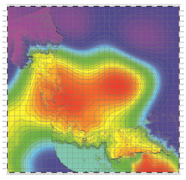
 Passing by Oroluk Atoll, and transiting to Pohnpei (Ponape) Island. Oroluk has two (E and W) rift zones or parasitic cones, then transited to a small seamount, roughly E of Oroluk, found it to be rather flat topped. Subsequently transited to the submarine part of Sapwuatik/Ngatik Atoll: this feature forms an underwater near-circular mountain that has four peaks (N, S, E, W) that seem flat-topped, and an extremely flat surface within that stands about 1500 m above the seafloor (see image at left) – this may be an old lagoon? Also started mapping the submarine foot of Pohnpei (Ponape).
Figure: Multibeam bathymetry superimposed on Smith and Sandwell gravity-based bathymetry. Note flat tops and flat floor inside this structure.
- Jasper Konter
Created by Anthony Koppers on Sunday, 28 July 2013 and updated on Saturday, 10 August 2013
- 1142 reads