|
ERESE Master Document Index: |
|
| Teachers Log | Back to index |
| ERESE
Teachers Log |
|
| Lesson
title |
Earth's
Magnetic Field asnd the Rock Record |
| Intent
of the lesson |
Students
will be able to make connections between what they have learned about
magnets and magnetism and our understanding of the natural world. |
| Ed.
standards |
CA
State Science Standards Physics: Electric and Magnetic Phenomena 5. Electric and magnetic phenomena are related and have many practical applications. As a basis for understanding this concept: e. Students know charged particles are sources of electric fields and are subject to the forces of the electric fields from other charges. f. Students know magnetic materials and electric currents (moving electric charges) are sources of magnetic fields and are subject to forces arising from the magnetic fields of other sources. g. Students know how to determine the direction of a magnetic field produced by a current flowing in a straight wire or in a coil. j. * Students know electric and magnetic fields contain energy and act as vector force fields. Earth Science: Dynamic Earth Processes 3. Plate tectonics operating over geologic time has changed the patterns of land, sea, and mountains on Earth's surface. As the basis for understanding this concept: a. Students know features of the ocean floor (magnetic patterns, age, and sea-floor topography) provide evidence of plate tectonics. |
| Orientation |
Prior
to this lesson students will have had a unit on electricity and an
introductory activity on magnetism. Orientation will include a
review of the major points from the intro on magnetism. |
|
Intent |
Students
will remember the essentials of magnetism and magnets so that they can
learn about magnetic fields around bar magnets and the magnetic field
of the earth. |
| Procedure | 1.
Concept Review
|
|
Type of Evidence |
Questioning |
|
Teacher profile |
2.5
- Facilitates and experience with general instructions (no adaptations) I will ask questions like "Why are all the compasses pointing north?" (no bar magnet) Why do they change orientation when the bar magnet is place among them. What do you think will happen if you move the compasses further and further away from the magnet? Why is this happening? " Rotate magnet - "Why does the orientation of the compasses change?" Set up on table - "why do the compasses change their orientation as they are moved away from the magnet? What does this tell you about the influence of the bar magnet on magnetic materials?" |
|
Student profile |
1.5
Students will make drawings, answer questions and may ask some
clarifying questions. |
| Fieldwork |
Give students experience to foster their interest and ownership; provoke students to explore, observe and generate their own questions about the phenomenon |
|
Intent |
|
|
Procedure |
Spreading
Center Simulation
2. Teacher sets up bar magnet and compasses reproduces drawings and instructs students that North at top of drawing represented by colored marker South at top represented by no color.<> <> 3. Teacher orients magnet N and counts to 5. Students color in 5 squares. Teacher orients magnet S and counts to 7. Students leave 7 squares blank. Teacher continues alternating N and S with bar magnet several more times 4. Teacher sets up an activity that mimics the action of a magnetometer as it is dragged perpendicular to a spreading center. Teacher lays a strip of paper showing the recent magnetic reversal pattern across a table and places a series of bar magnets under the paper oriented appropriately. Students will walk slowly along the table holding a compass close the the edge of the paper strip observing the changes in compass orientation. Teacher will provide students with a table of 5 items to examine. They will be instructed to examine each piece of work and make observations focusing on the connections between the orientation and the simulation portion of the fieldwork. They will generate at least 2 questions for each item. Students will fill in their observations and questions in the provided table. Provacative Phenomena are: Magnetic field lines at pole of bar magnet Magnetic Anomaly Relationships Magnetic Anomaly Cross section Magnetic Anomalies Magnetic Anomalies (color) |
|
Type of Evidence |
Questioning |
|
Teacher profile |
During
the fieldwork portion I will be expecting different behaviors at
different times.
|
|
Student profile |
During
the fieldwork portion I expect different studeent behaviors at
different times.
|
| Debriefing |
Teacher honors all student observations, questions and hypotheses in order to identify and discuss their viability as a research topic. |
|
Intent |
Hear
all student observations and questions, and help them to form
hypopotheses of their own. |
|
Procedure |
Ask
students to share observations and questions for each phase of
fieldwork and record on chart paper. Limit observations/questions
to one per student so that everyone has a chance to contribute. |
|
Type of Evidence |
Observations
and questions |
|
Teacher profile |
#1
Teachers asks students to share their won observations and generate
their own questions and only assists in elaborating. |
|
Student profile |
#4
Students generate their own responses to the fieldwork experience
through observations and questions. |
| Experimental
design |
Design an investigation wherein students gather and analyze data that address the identified question |
| Data
collection |
Define
approach for collecting data |
|
Intent |
Students
will examine data and images that teacher makes available in order to
research the following hypothesis:
|
|
Procedure |
Students
will study the links below and focus on the questions below. magnetic anomaly models What are the similarities between the magnetic stripes in each model? What are the differences? What is the connection between the magnetic profile and the magnetic striping? ship map and magnetic profile What connections can you make between the walk you took along the magnetic table stripes and the ship track on the map? What is the relationship between the map, the magnetic profile and the magnetic stripes. 4 Ocean Magnetics How do these figures relate to the models? What differences/similarities do you see between the data for the northern and the southern hemispheres? What is the connection between this information and the magnetic anomaly models? magnetic reversals 3-d Where do you find the oldest rocks? How do you know? |
|
Type of Evidence |
Questioning |
|
Teacher profile |
#3
Students don't have access to individual computers, so teacher makes
copies of data listed above and suggests some guiding questions to use
during their examination. |
|
Student profile |
#2
Students are given data and asked to analyze with some direction from
teacher. |
| Data
analysis |
Define approach for analyzing data |
|
Intent |
Students
will be able to prove or disprove their hypothesis using the data
provided by teacher. |
|
Procedure |
magnetic
anomaly models Students will examine each set of magnetic data and compare stripes and highs and lows. Advanced students may be able to calculate spreading rates. ship map and magnetic profile Students will recall their experiences during fieldwork and try to relate what they see here. Should include detailed instructions of the process and a description of any content lessons necessary to achieve this stage 4 Ocean Magnetics Students will examine the 3 types of data for each ocean site and compare the data for northern and southern hemispheric sites and fast and slow spreading centers. magnetic reversals 3-d This figure is a cartoon summary of sea-floorspreading, magnetic reversals and the time scale. Data from other sources can be related to this figure and used to support the hypothesis. |
|
Typre of Evidence |
Questioning |
|
Teacher profile |
#2
Teacher provides some guidance for those that are still having some
trouble with some of the data. |
|
Student profile |
#3
Some students will be able to formulate their own explanations from the
evidence, some will need lots of direction, but most should be able to
be guided through the process. |
| Presentation |
Teacher provides students an opportunity to prepare and communicate what they have learned. |
|
Intent |
Give
the students the opportunity to present their findings to the class. |
|
Procedure |
Students
have produced at leasst one lab report and have had the opportunity to
present the results of experiments, activities and projects to the
class. Should
include detailed instructions of the process and a description of any
content lessons necessary to achieve this stage |
|
Type of Evidence |
Questioning |
|
Teacher profile |
#2
Teacher prepares a presentation rubric but allows students latitude in
the vehicle they use to present their findings. |
|
Student profile |
#2.5
Students will follow the presentation rubric and will be given
additional direction if needed. |
| CP0001 Expedition - Cruise Planning | Back to index |
| M00001 Simple Seafloor Spreading (Reykjanes Ridge) | Back to index |
| Standard | Subject | ||||||
| M00001 | Simple Seafloor Spreading | ||||||
| General Metadata | |||||||
| magnetic
anomalies, seafloor spreading, magnetic stripes, magnetism, magnetic
anomaly, mid-ocean ridge |
|||||||
| Level (L) | Images (I) | Data (D) | Text (T) | ||||
| 1-2 (Elementary) |
Photograph of bar magnet and nearby iron filings | Index Page | |||||
| 3 (Middle School) |
Magnetic Seafloor and Deeper Reversals | Table 1: Le Pichon 1968 | Index Page | Definition of Mid-Ocean Ridge | Index Page | ||
| 4 (High School) |
Age of the Seafloor Along Reykjanes Ridge | Index Page | Cross-Section Formation of Magnetic Anomalies with Geologic Timescale | Index Page | Definition of Seafloor Spreading | Index Page | |
| 5 (College) |
Magnetic Polarities Along Reykjanes Ridge | Index Page | Magnetic Poloraity and Ocean Depth Versus Longitude Along the Reykjanes Ridge | Index Page | Abstract-Heirtzler et al 1966 | Index Page | |
| 6-9 (Graduate & Research) |
Figure 1: Heirtzler et al 1966 | Index Page | Figure 2-Heirtzler et al 1966 | Index Page | Abstract-Heirtzler et al 1966 | Index Page | |
| M00002 Complex Seafloor Spreading | Back to index |
| Standard | Subject | ||||||
| M00002 | Complex Seafloor Spreading | ||||||
| General Metadata | |||||||
| magnetic
anomalies, seafloor spreading, magnetic stripes, |
|||||||
| Level (L) | Images (I) | Data (D) | Text (T) | ||||
| 1-2 (Elementary) |
Seafloor Spreading Animation | Index Page | |||||
| 3 (Middle School) |
Magnetic Particles in Oceanic Sediment | Index Page | Cross-Section Formation of Magnetic Anomalies with Geologic Timescale | Index Page | Text 01 from Vine 1966 | Text 01 from Vine 1966 | |
| 4 (High School) |
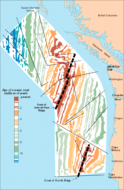
Magnetic Anomalies Off the Coast of the Pacific Northwest | Index Page | Geomagnetic-Polarity Epochs and Respective Age of Seafloor | Index Page | Text 04 from Vine 1966 | Text 04 from Vine 1966 | |
| Magnetic Anomalies and the Sea-floor Spreading Rate | Index Page | ||||||
| 5 (College) |
Figure 1-Vine 1966 (Raff & Mason) | Index Page | Table 1. Mid-Ocean Ridge Data Table (Wilson) | Index Page | Chapter 2 Mason - Oreskes | Chapter 2 Mason - Oreskes | |
| Multiple Maps of Diverging Plate Boundary and Cruise Paths | Index Page | Magnetic Profile and Map of Spreading Center | Index Page | ||||
| 6-9 (Graduate & Research) |
Magnetic Anomaly Data for Multiple Seafloor Locations | Index Page | Magnetic Anomlay Data from Multiple Seafloor Locations | Index Page | Chapter 3 Vine - Oreskes | Chapter 3 Vine - Oreskes | |
| Map of Diverging Plate Boundary and Cruise Path | Index Page | Magnetic Profiles and Map of Diverging Plate Boundary | Index Page | ||||
| M00006 Magnetic Reversals | Back to index |
| Standard | Subject | ||||||
| M00006 | Magnetic Reversals | ||||||
| General Metadata | |||||||
| magnetic field reversals, geomagnetic field reversals | |||||||
| Level (L) | Images (I) | Data (D) | Text (T) | ||||
| 1-2 (Elementary) |
Magnetic Reversal Video Along a Spreading Center | Index Page | Magnetic Rock Sample Polarity Data Table | Index Page | Definition of Magnetic Reversal - Elementary School | Index Page | |
| 3 (Middle School) |
Figure of a Normal and Reversed Magnetic Field | Index Page | Magnetic Reversal Data and Timescale | Index Page | Definition of Magnetic Reversal - Middle School | Index Page | |
| 4 (High School) |
Direction of Changing Magnetic Poles based on Basalt Samples in Japan | Index Page | Magnetic Reversal Data Table | Index Page | |||
| Magnetic Profiles | Index Page | ||||||
| 5 (College) |
Magnetic Field Reversal Video | Index Page | Magnetic Profile Data Across the East Pacific Rise | Index Page | |||
| 6-9 (Graduate & Research) |
Magnetic Reversals Based on Dipole and Nondipole Field Strength | Index Page | Paleomagnetic Data of Field Intensity and Polarity | Index Page | Chapter 6 - Oreskes: Morley | Chapter 6 - Oreskes: Morley | |
| M00008 Seamounts | Back to index |
| Standard | Subject | ||||||
| M00008 | Seamounts | ||||||
| General Metadata | |||||||
| Level (L) | Images (I) | Data (D) | Text (T) | ||||
| 1-2 (Elementary) |
|||||||
| 3 (Middle School) |
|||||||
| 4 (High School) |
Bathymetric map of the Magellan Seamount Trail including Vlinder Morphology Analysis | Index Page | |||||
| Bathymetry of the Magellan Seamount Trail | Index Page | ||||||
| Ralik and Ratak Seamount Trails | Index Page | ||||||
| 5 (College) |
Map of West Pacific Seamount Province | Index Page | |||||
| Map of the Japanese Seamount Trail | Index Page | ||||||
| WPSP Seamount Trails | Index Page | ||||||
| 6-9 (Graduate & Research) |
West Pacific Seamount Province and the Japanese Seamounts | Index Page | |||||
| Northern and Southern Wake Seamount Trails | Index Page | ||||||
| Euler Pole derivation | Index Page | ||||||
| M00013 Tectonic Plates | Back to index |
| Standard | Subject | ||||||
| M00013 | Tectonic Plates | ||||||
| General Metadata | |||||||
| plate tectonics, tectonic plates, crustal blocks, lithospheric plates | |||||||
| Level (L) | Images (I) | Data (D) | Text (T) | ||||
| 1-2 (Elementary) |
The Earth's Layers | Index Page | Plate Tectonics and Volcanoes | Index Page | Definition of Lithospheric Plates and Plate Tectonics | Index Page | |
| 3 (Middle School) |
The Major Tectonic Plates of the World | Index Page | Map of Tectonic Plates and Their Movement | Index Page | Fill-in-the-Blank Plate Tectonic Exercise | Index Page | |
| 4 (High School) |
Map of the North American Plate and the Eurasian Plate Diverging Over Iceland | Index Page | Geology of Africa and South America | Index Page | |||
| 5 (College) |
Diagram Illustrating Components of Plate Tectonics | Index Page | Movement between Tectonic Plates (Table 5) | Index Page | Chpt 1. -- Oreskes | Index Page | |
| 6-9 (Graduate & Research) |
Rates of Plate Rotation (Table 4) | Index Page | Abstract -- Morgan | Abstract -- Morgan | |||
| M00016 Convergent Boundaries | Back to index |
| Standard | Subject | ||||||
| M00016 | Convergent Plate Boundaries | ||||||
| General Metadata | |||||||
| Level (L) | Images (I) | Data (D) | Text (T) | ||||
| 1-2 (Elementary) |
The Eurasian Plate and Indian Plate Converging to Create the Himalayas | Index Page | |||||
| 3 (Middle School) |
Subduction Zone | Index Page | Relationship of Temperature and Earthquakes in a Downgoing Slab | Index Page | |||
| 4 (High School) |
The Collision of Two Continents | Index Page | Temperature Distribution in a Sinking Lithospheric Plate Compared to Surrounding Mantle | Index Page | Converging Plate Boundaries | Index | |
| Global image of the Pacific Margins | Index Page | ||||||
| 5 (College) |
|||||||
| 6-9 (Graduate & Research) |
|||||||
| M00017 Divergent Boundaries | Back to index |
| Standard | Subject | ||||||
| M00017 | Divergent Plate Boundaries | ||||||
| General Metadata | |||||||
| divergent plate boundary, spreading center | |||||||
| Level (L) | Images (I) | Data (D) | Text (T) | ||||
| 1-2 (Elementary) |
Simple Figure for a Divergent Boundary | Index Page | Simple Definition of Divergent Plate Boundaries | Index Page | |||
| 3 (Middle School) |
Image of a Divergent Boundary | Index Page | Heat Level Data Over Divergent Boundary | Index Page | Definition of Divergent Plate Margins - Middle School | Index Page | |
| 4 (High School) |
Divergent Boundary Between Two Continents | Index Page | Gravity Data Over Oceanic Ridge | Index Page | |||
| 5 (College) |
Topographic Map of a Divergent Plate Boundary | Index Page | |||||
| 6-9 (Graduate & Research) |
|||||||
| M00018 Strike Slip Boundaries | Back to index |
| Standard | Subject | ||||||
| M00018 | Strike-Slip Plate Boundaries | ||||||
| General Metadata | |||||||
transform faults, strike-slip faults |
|||||||
| Level (L) | Images (I) | Data (D) | Text (T) | ||||
| 1-2 (Elementary) |
3-D Image with Arrow Plate Motion | Index Page | |||||
| 3 (Middle School) |
Transform fault at Mid-Ocean Ridge vs. Seafloor Age | Index Page | Definition of Transform Fault | Index Page | |||
| 4 (High School) |
Fig. 1-Wilson 1965: Transform and Transcurrent Faults | Index Page | Text 01-Wilson
1965: Definition of Transform and Transcurrent Faults |
Text 01-Wilson
1965: Definition of Transform and Transcurrent Faults *need to scan & archive* |
|||
| 5 (College) |
Mendocino Transform Fault | Index Page | |||||
| 6-9 (Graduate & Research) |
Fig.3-Wilson 1965: Juan de Fuca Ridge and related faults | Index Page | Table 1-Wilson 1965: Location of points on Figure 3 | Index Page | |||
2004-07-19 09:15 AM