| ERESE Teacher Lesson Plan Template (CEO1A) |
| Teacher Name | Phyllis
Butler |
| Lesson Title | Exploring
Oceanic Seamounts |
| Grade | Eleventh
and Twefleth grades |
| School | Kellam
High School |
| City, State | Virginia
Beach, Va. |
| Purpose
of Lesson |
To
encourage students to learn to ask inquiry questions about seamounts.
To encourage students to develop effective hypotheses concerning the
development, discovery , and composition of seamounts.To encourage
students to use relevant and real time data to discover the answers to
their own inquiries and hyptheses. about seamounts |
| Education
Standards |
ES.1
The student will plan and conduct investigations in which * volume,
area, mass, elapsed time, direction, temperature, pressure, distance,
density, and changes in elevation/depth are calculated utilizing the
most appropriate tools; * technologies, including computers, are used
to collect, analyze, and report data and to demonstrate concepts and
simulate experimental conditions; * scales, diagrams, maps, charts,
graphs, tables, and profiles are constructed and interpreted; *
variables are manipulated with repeated trials; and * a scientific
viewpoint is constructed and defended. ES.2 The student will demonstrate scientific reasoning and logic by * analyzing how science explains and predicts the interactions and dynamics of complex Earth systems; * recognizing that evidence is required to evaluate hypotheses and explanations; * comparing different scientific explanations for the same observations about the Earth; * explaining that observation and logic are essential for reaching a conclusion; * evaluating evidence for scientific theories related to plate tectonics, the structure of the Earth, and its ancient age and origin; and * making informed judgments related to resource use and its effects on Earth systems. ES.3 The student will investigate and understand how to read and interpret maps, globes, models, charts, and imagery. Key concepts include * maps (bathymetric, geologic, topographic, and weather) and star charts; * imagery (aerial photography and satellite images); * direction and distance measurements on any map or globe; and * location by latitude and longitude and topographic profiles. ES.4 The student will investigate and understand the characteristics of the Earth including * plate tectonics; * water in all three states; * position of the Earth in the solar system; and * effects of density differences and energy transfer on the activities of the atmosphere, oceans, and Earth's interior . ES.5 The student will investigate and understand how to identify major rock-forming and ore minerals based on physical and chemical properties. Key concepts include * properties including hardness, color and streak, luster, cleavage, fracture, and unique properties; and * uses of minerals. ES.6 The student will investigate and understand how to identify common rock types based on mineral composition and textures and the rock cycle as it relates to the transformation of rock types. Key concepts include * igneous (intrusive and extrusive); * sedimentary (clastic and chemical); and * metamorphic (foliated and unfoliated) rocks. ES.8 The student will investigate and understand geologic processes including plate tectonics. Key concepts include * how geologic processes are evidenced in the physiographic provinces of Virginia including the Coastal Plain, Piedmont, Blue Ridge, Valley and Ridge, and Appalachian Plateau; * processes (faulting, folding, volcanism, metamorphism, weathering, erosion, deposition, and sedimentation) and their resulting features; and * tectonic processes (subduction, rifting and sea floor spreading, and continental collision). ES.10 The student will investigate and understand that many aspects of the history and evolution of the Earth and life can be inferred by studying rocks and fossils. Key concepts include * traces or remains of ancient, often extinct, life are preserved by various means in many sedimentary rocks; * superposition, cross-cutting relationships, and radioactive decay are methods of dating bodies of rock; * absolute and relative dating have different applications but can be used together to determine the age of rocks and structures; and * rocks and fossils from many different geologic periods and epochs are found in Virginia. ES.11 The student will investigate and understand that oceans are complex, interactive physical, chemical, and biological systems and are subject to long- and short-term variations. Key concepts include * physical and chemical changes (tides, waves, currents, sea level and ice cap variations, upwelling, and salinity concentrations); * importance of environmental, geologic, and economic implications; * systems interactions (energy transfer, weather, and climate); * features of the sea floor (continental margins, trenches, mid-ocean ridges, and abyssal plains) reflect tectonic processes; and * public policy issues concerning the oceans. . Science Standards of Learning for Virginia |
| INQUIRY STAGE 1 | |
| Orientation |
Introduce
available tools and concepts |
|
Purpose |
To encourage students to observe and to evaluate the location and the evolution of seamounts.. |
| Procedure | Students will be
in groups, and they will answer 6 questions about the bathymetry of
four
different maps. They will also work in pairs on laptops to observe the
amount of data availbale to study seamounts.There will be a student led
discussion about the formaton and location of seamounts.along with
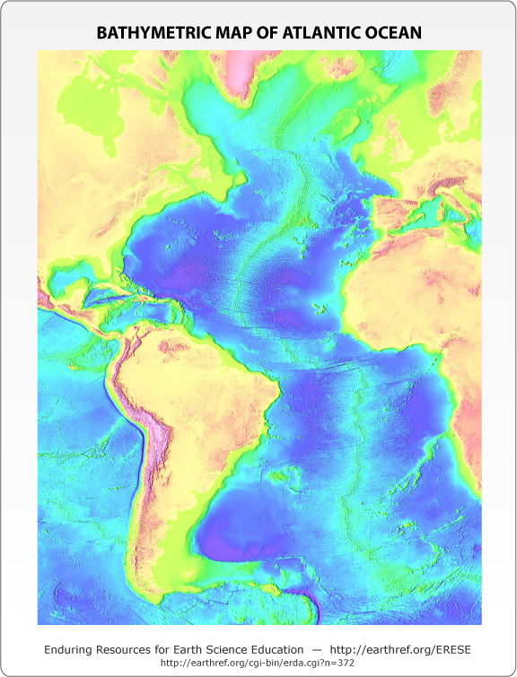
rigdes, guyots, abbyssal hills, and abbysal plains. Hot spot data http: //earthref.org/ERESE/index.html .Bathymetric link of the Atlantic Ocean Link to Volcano data Bathymetry and Magnetic reversalsreversalsfile:///C:/Documents%20and%20Settings/sdsc/Desktop/HowIsMagnetismUsedToExplainPlateTectonics.html The six questions about the ocean floor will be; How are seamounts formed? Do hot spots influence the formation of seamounts? Can seamounts be accurately dated? Are seamounts found near mid ocean ridges? Are seamounts older than the ocean floor they are located on? |
| INQUIRY
STAGE 2 |
|
| Fieldwork |
Provide
students with provoking, relevant phenomena |
| Purpose | To allow the student to pursue their interest in the topography ( bathymetry) of the sea floor by generating a model of the sea floor., and developing inquiry questions of their own. |
|
Procedure |
The
provocative
phenomena would be both a Plate Lab Map and a Clay sea floor model Plate Tectonics Students will be given a lab with co-ordinates to plot for earthquakes, ridges, trenches, and volcanoes Some students will read the directions. Some students will interpret the directions. Individually students will plot the co-ordinates, They will outline the plate boundaries , connect trenches and ridges. They willl answer questions relating to plate boundaries, and plate movement OBSERVATION PLate Map Lab Some students will notice that there is more volcanic activity near the "ring of fire" Some students will wish they had a bigger map to work with Some students willbe concerned about having enough tiime to finish Clay Sea Floor Model Students will select a specific bathymetric map to use in groups They will create a clay model of the sea floor to mimic the bathymetric map that they choose They will label this map with numerous features such as; seamounts, guyots, trenches. ridges. rift valleys, earthquakes, and plate boundaries Clay Sea Floor Model Some students will really enjoy doing this ' hands on" lab Some students will have a difficult time getting stared. Each group will need to be responsible for their own actions and their own productivity. Roles will be chosen by lot to include Promoter, Artists, Analysists, and Detailer. |
| INQUIRY
STAGE 3 |
|
| Debriefing |
Teacher honors all student observations. |
| Purpose | Students will work in groups to determine the best four possible hypotheses about Seamounts .The teacher will walk around to the individual groups to discuss their thoughts and their progress. |
|
Procedure |
There will be a
discussion about the scientific process including; the question, the
hypotheses, the variables, the constants ,and the conclusion. With teacher will guide the class will choose the four best hypotheses to investigate. Students will be given a rubric to explain the types of labs that they may choose from to support their hypothesis. These are the four hypotheses that the
students will be guided to investigate;
1. Seamounts are formed
by hot spots 2. Seamounts are older than the seafloor they are located on. 3. Seamounts are found near active spreading centers. 4. Seamounts become eroded and become more dense as they move away from their point of origin |
| ?INQUIRY
STAGE 4 |
|
| Experimental
design |
Design
an appropriate investigation |
|
Data
collection |
Define approach for collecting data. |
| Purpose | For
students
to use maps to answer the six specific questions about Seamounts. For students to use the laptops to gain knowledge about current findings involving Seamounts to answer specific questions. |
|
Procedure |
Students will break into five groups of no more then four individuals who wish to prove the same hypothesis. The students will be given a rubric which will be the basis of the Seamount Lab. Once in their groups, the students will choose which type of lab they will explore to prove their hypothesis.to best fulfill this rubric Choices of resources available will be; Use of maps as a primary resource to answer the hypothesis they choose. Use of data from websites particularly the ERESE and Earthref sites http: //earthref.org/ERESE/index.html . Bathymetric link of the Atlantic Ocean Link to Volcano data Bathymetry and Magnetic reversalsfile:///C:/Documents%20and%20Settings/sdsc/Desktop/HowIsMagnetismUsedToExplainPlateTectonics.html Hot Spots Use of current articles pertaining to their hypothesis. Use of all of these sources as a data base for their lab. Upon accumulation of this data students will complete their lab rubric. |
|
Data
analysis |
Define
approach for analyzing data. |
| Purpose | To substantiate the findings of each of the groups concerning the validity of their hypothesis. |
|
Procedure |
Students will use
data from graphs and from charts found on theERESE site to create their
own graph about seamounts. Students will write an analysis of the graph information whihc they have created. |
| INQUIRY
STAGE 5 |
|
| Presentation |
Students
will communicate
what they have learned |
| Purpose | Students
will communicate their results to one another by presenting their
hypothesis and by debating with one another about its scientific merits. |
|
Procedure |
Students will
create a model of their hypothesis ( poster board, etc.) Students will have a written hypothesis and complete scientific model. Students may create a power point about their findings Students will base this presentations upon the three provocative lessons about Seamounts. |
| ERESE
Teacher Reflective Plan Template |
|
| INQUIRY STAGE 1 |
|
| Orientation |
Introduce
available tools and concepts so that students feel safe taking
intellectual risks |
|
Type of Evidence |
Students
questions, attentiveness, and correct answers are an
indication of their interest |
|
Teacher profile |
3
= directs via general instructions |
|
Student profile |
`1
= follows specific directions |
| Reflective
practice |
|
| INQUIRY STAGE 2 |
|
| Fieldwork |
Give
students experience to foster their interest and ownership, provoke
students to explore, observe and generate their own questions about the
phenomenon. |
|
Type of Evidence |
The
questions that students ask about the labs , and their
completed labs will indicate their understanding. |
|
Teacher profile |
2
= guides the development of a focus for observations, allows for
adaptations |
|
Student profile |
3
=selects, adapts, modifies observations |
| Reflective practice | |
| INQUIRY STAGE 3 |
|
| Debriefing |
Teacher honors all student observations,
questions and hypotheses in order to identify and discuss their
viability as a resaerch topic. |
|
Type of Evidence |
Teacher
will observe student understanding by listening to their interact
regarding the topic of Seamounts |
|
Teacher profile |
2=
guides the development of questions |
|
Student profile |
4=
creates/formulates data collection/analysis approach |
| Reflective practice | |
| INQUIRY STAGE 4 |
|
| Experimental
design |
Design an investigation wherein students gather and analyze data that address the identified question.. |
| A.
Data
collection |
Define approach for collecting data |
|
Type of Evidence |
Bathymetric
maps with be used along with internet Seamount sources. |
|
Teacher profile |
1
= Facilitates students to determine what evidence to collect and
methods for collection. |
|
Student profile |
4
= Creates/formulatesdata collection/analysis approach |
| Reflective practice | |
| B.
Data
analysis |
Define
approach for analyzing data |
|
Type of Evidence |
Bathymetric
maps, pertinent articles and internet souces about Seamounts. |
|
Teacher profile |
1 = Facilitates formation of logical arguments to explain data |
|
Student profile |
4= Creates/formulates reasonable and logical arguments and presentation forma |
| Reflective practice | |
| INQUIRY STAGE 5 |
|
| Presentation |
Teacher provides students an opportunity
to prepare and communicate what they have learned |
|
Type of Evidence |
Bathymetric
maps, Plate Tectonic Map Lab, and Clay Seamount Lab are the evidence,
and they are the provocative phenomena. |
|
Teacher profile |
1
= Facilitates formation of logical arguments to explain data |
|
Student profile |
4=
Creates/formulates reasonable and logical arguments and presentation
format |
| Reflective practice |