ERESE Teacher Lesson Plan Template (CEO1A)

Teacher Name

Susanne S. Schissel

Lesson Title

"Secrets of the Ocean Floor: Exploring Seafloor Features and Bathymetry"

Grade

7 - 9

School

La Jolla Country Day School

City, State

La Jolla, California

Purpose of Lesson

Students will;

  • Develop the understanding that the bottom structure of the ocean floor can be mapped.
  • Describe something they cannot see through the collection and correlation of accurate data.
  • Understand how technology can be applied as a tool for problem-solving.

Education Standards

National Science Education Standards for Grades 9-12:

  • Scientists in different disciplines ask different questions, use different methods of investigation, and accept different types of evidence to support their explanations.
  • Lithospheric plates on the scales of continents and oceans constantly move at rates of centimeters per year in response to movements in the mantle. Major geological events, such as earthquakes, volcanic eruptions, and mountain building, result from these plate motions.
  • Land forms are the result of a combination of constructive and destructive forces. Constructive forces include crustal deformation, volcanic eruption, and deposition of sediment, while destructive forces include weathering and erosion.
  • The outward transfer of Earth's internal heat drives convection circulation in the mantle that propels the plates comprising Earth's surface across the face of the globe.

California State Standards:

  • Scientific progress is made by asking meaningful questions and conducting careful investigations. As a basis for understanding this concept and addressing the content in the other three strands, students should develop their own questions and perform investigations. Students will:
    • a. Plan and conduct a scientific investigation to test a hypothesis.

      b. Evaluate the accuracy and reproducibility of data.


  • Plate tectonics operating over geologic time has changed the patterns of land, sea, and mountains on Earth's surface. As the basis for understanding this concept:
    • a. Students know features of the ocean floor (magnetic patterns, age, and sea-floor topography) provide evidence of plate tectonics.

      b. Students know the principal structures that form at the three different kinds of plate boundaries.

      c. Students know how to explain the properties of rocks based on the physical and chemical conditions in which they formed, including plate tectonic processes.

Technology (ISTE) Standards:

Basic Operations and concepts:

  • Students demonstrate a sound understanding of the nature and operations of technology systems.
  • Students are proficient in the use of technology.

Technology Productivity Tools:

  • Students use technology tools to enhance learning, increase productivity, and promote creativity.

Technology Communications Tools:

  • Students use telecommunications to collaborate, publish, interact with peers, experts, and other audiences.

Technology Research Tools:

  • Students use technology to locate, evaluate, and collect information form a variety of sources.
  • Students evaluate and select new information resources and technological innovations based on the appropriateness to specific tasks.
  • Students use technology tools to process data and report results.

Technology Problem-Solving and Decision-Making Tools:

  • Students use technology resources for solving problems and making informed decisions.
  • Students employ technology in the development of strategies for solving problems in the real world.

INQUIRY STAGE 1

Orientation

Introduce available tools and concepts.

Purpose

  • Make students feel safe taking intellectual risks;
  • Provide direction through general instructions in order to review students' prior knowledge of plate tectonics and seafloor features

Procedure

I will draw out student knowledge and comprehension of plate tectonics and seafloor features

"Today, we will need to put on our "geologist hats" and think like an Earth Scientist."

"What do you know about the following?

  • maps
  • scales
  • number lines, quadrants, graphs
  • tectonic plates
  • continental drift
  • features of the ocean floor

I will list all comments/questions on the white board, and preview and clarify any vocabulary terms that come up during the brainstorming session that they will need to understand for the fieldwork.

INQUIRY STAGE 2

Fieldwork

Provide students with provoking, relevant phenomena.

Purpose

To foster their interest and ownership and generate their own questions about the phenomena.

Procedure

1. I will divide the students into 6 groups of (ideally) 3. There could be 2 or 4 students per group.

2. I will instruct the students to go to their lab stations where three activities will be set up. Students should be allowed 2 - 4 days to complete the fieldwork activity, depending upon the length of the class period.

  • Reading bathymetric maps (use hard copies or an on-line map (example)
    1. What do the colors represent?
    2. What does the key indicate?
    3. What is the scale?
    4. What units are used in the scale?
    5. What do the numbers on the margin represent?
    6. Can you identify a body of water?
    7. What land masses can you identify?
    8. What features are above/below sea level?


  • Ocean Floor Mapping Simulation (choose one: A, B, C, or D)
    1. Does the cut out model and/or contour map look like your ocean floor shoebox model? Explain.
    2. Were any features missed? Why?
    3. Do you think oceanographers have similar problems during their investigations?
    4. How could you have improved the accuracy of your results?


  • Sea What We Can Map (Lab #24, PASPORT Explorations in Earth and Environmental Science -- Use a PASCO Motion Sensor to investigate the concept of ocean floor mapping.
    1. Draw a profile of the structures you have placed on the floor as you would expect to see as graphed by a motion sensor.
    2. How does the computer graph compare to your prediction?
    3. If there are differences, how would you explain them?
    4. What would you need to do to make this graph match your predicted profile?
    5. Were any features missed? Why?
    6. Do you think oceanographers have similar problems during their investigations?
    7. How could you have improved the accuracy of your results?


3. Students will be asked to record their responses to all of the questions in the activity as well as their observations of the provocative phenomena.


4. Anticipated Observations/Questions:

  • Colors represent height.
  • Zero altitude is sea level. Positive numbers are land forms above water, and negative is below.
  • Only ocean floor features are shown; no land forms are shown
  • The ocean gets deeper as you move away from the continents.
  • In some places, there is a rapid change in depth by the continents, and in other places, the change is gradual.
  • The skewer does not go down to the same depth each time.
  • The skewer is hitting something on the bottom of the box
  • The skewer goes down different distances in different holes
  • The distance the skewer goes down can be measured and graphed to create a profile.
  • The motion sensor's computer graph is an upside down version of my prediction.
  • The sensor did not pick up a feature if I did not move it over the feature.

INQUIRY STAGE 3

Debriefing

Teacher honors all student observations.

Purpose

Facilitates learners in generating questions

Procedure

  1. Ask each student to share their observations and write them up on the whiteboard.
  2. Begin with observations about Activity #1 and go around the room until noone has anything new to contribute.
  3. Encourage questions that begin with "I wonder about..." or "I wonder why.."
  4. Continue with the above procedure until all of the activities have been covered.
  5. Ask the students to look at the observations and observe common themes. Probable topics: seafloor features, bathymetry, creation of maps
  6. Identify researchable questions such as:
    • How does the Pacific Ocean's (or other parts of the ocean) bathymetry compare to other parts of the world? Why/how is it different?
    • Does the margin between continents and the ocean vary a lot from place-to-place, and if so, how?
    • If you create a profile of the ocean floor using depth and distance, can you determine what seafloor features are present?
    • How is data is collected by oceanographers in order to map seafloor bathymetry? What are the pros/cons/effectiveness of these methods?
    • How is the data collected by oceanographers used to represent the geography of the ocean floor?

INQUIRY STAGE 4

Experimental Design

  1. Students will remain working with the same lab partners from the Fieldwork phase.
  2. They will choose one of the researchable questions created from the Debriefing phase. 
  3. Each group will devise a testable hypothesis for its research question.
  4. After a review and approval of their hypotheses by me, they will begin to gather researchable evidence.

Data collection

Define approach for collecting data.

Purpose

Gather data that address the identified question and hypothesis.

Procedure

  1. Students will gather the information that they will need toprove or disprove their hypotheses from the following matrices; Enduring Resources in Earth Science Education (ERESE), Resources Matrix EarthRef.org Digital Archive (ERDA), SIO Explorer (Scripps Institute of Oceanography)
  2. If the supporting data and information are not found in the matrices provided, students may search for the information from other sources.
  3. Students will create a folder to save links to their data, images and data tables, and a record of citations. Any word-processing document (Word, Appleworks,..) is fine.
  4. Possible Content Lessons:
    • Introduce students to the resource matrices
    • Demonstrate the use of the Earthref.org
    • Review how to create a web page or document to which the data and citations can be save.

Data Analysis

Define approach for analyzing data.

Purpose

Analyze data that address the identified question and hypothesis

Procedure

  1. Student groups will decide if they have collected the appropriate data to support or disprove their hypotheses.  They will take this information and vizualize it in a brochure.
  2. A brochure template will be provided.  Each lab group will make their own graph.

INQUIRY STAGE 5

Presentation

Communicate what they have learned.

Purpose

Provide students an opportunity to communicate their results in a forum that reflects the scientific community.

Procedure

  1. Each small group of students should create a brochure to communicate their findings and conclusions to the rest of the class.
  2. They should refer to the rubric for guidance.
  3. A content lesson on how to configure and create a brochure will be conducted.


ERESE Teacher Reflective Plan Template

INQUIRY STAGE 1

Orientation

Introduce available tools and concepts so that students feel safe taking intellectual risks

Type of Evidence

Questioning

Teacher Profile

3: I will ask questions such as:

  • What do you know about plate tectonics?
  • What do you know about the ocean floor?
  • Is the ocean floor flat, or does it have features similar to those on land?
  • How do we know what is on the ocean floor?
  • What do you need to know or pay attention to in order to read a map?

Student Profile

2: Students will demonstrate their knowledge about plate tectonics and bathymetry by sharing their responses to the questions listed above.

Reflective Practice

INQUIRY STAGE 2

Fieldwork

Give students experience to foster their interest and ownership; provoke students to explore, observe and generate their own questions about the phenomenon

Type of Evidence

Questioning that demonstrates a shift in the ownership of the question from me to the students.

Teacher Profile

2: Provide focus for observation and allow for adaptation; I will ask questions such as, "What did you notice?", "What did you wonder about?", What did you see?"

Student Profile

3: Generates independent observations. Students should also be asking questions like 
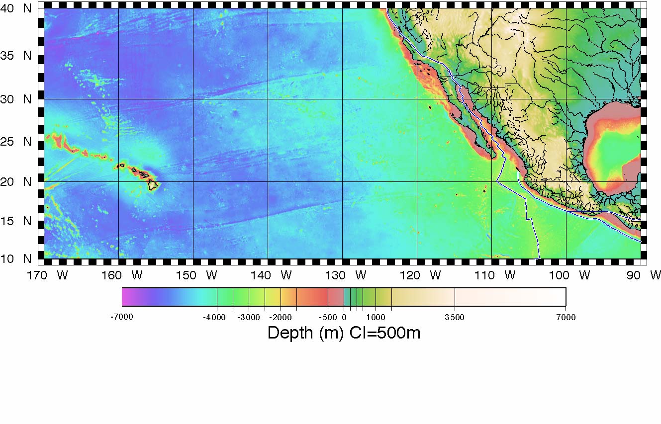
"How do we know what is on the bottom of the entire ocean floor if we haven't measured all of it?", "Why are some continental margins so different from others?", "I see patterns...."

Reflective Practice

INQUIRY STAGE 3

Debriefing

Teacher honors all student observations, questions and hypotheses in order to identify and discuss their viability as a research topic.

Evidence

Probing questions

Teacher Profile

1: Provides an opportunity to generate questions: What else did you notice? How are_____related?

Student Profile

4: Students are able to generate questions and connect their observations and questions to the major themes by answering and elaborating on my probing questions.

Reflective Practice

INQUIRY STAGE 4

Experimental Design

Design an investigation wherein students gather and analyze data that address the identified question

A. Data collection

Evidence

Questioning, probing for understanding

Teacher Profile

2: Guides students to the evidence to collect and how to collect it. What are you going after? What kinds of data will you need? Where will you get it?

Student Profile

3: Guided to collect specific data. They will be guided to several Internet resources, but will be allowed to choose which objects will help them to answer their questions. They should be saying things like "What do we need?", "What facts address our topic?

Reflective Practice

B. Data Analysis

Define approach for analyzing data

Evidence

Probing questions

Teacher Profile

1.5: Guides student to independently analyze and interpret data

Student Profile

3.5: Selects, adapts, and modifies the process for analysis. Formulates inferences based upon the findings.

Reflective Practice

INQUIRY STAGE 5

Presentation

Teacher provides students an opportunity to prepare and communicate what they have learned.

Evidence

Student generated brochure designed to represent what was learned

Teacher Profile

1.5: Guides and facilitates students in presenting findings and in forming logical arguments to explain data.

Student Profile

3.5: Selects, modifies, and creates logical arguments and presentation format.

Reflective Practice