Daily Report 6 -- Friday, 23 March 2012 -- Exploring the hidden world of seamounts
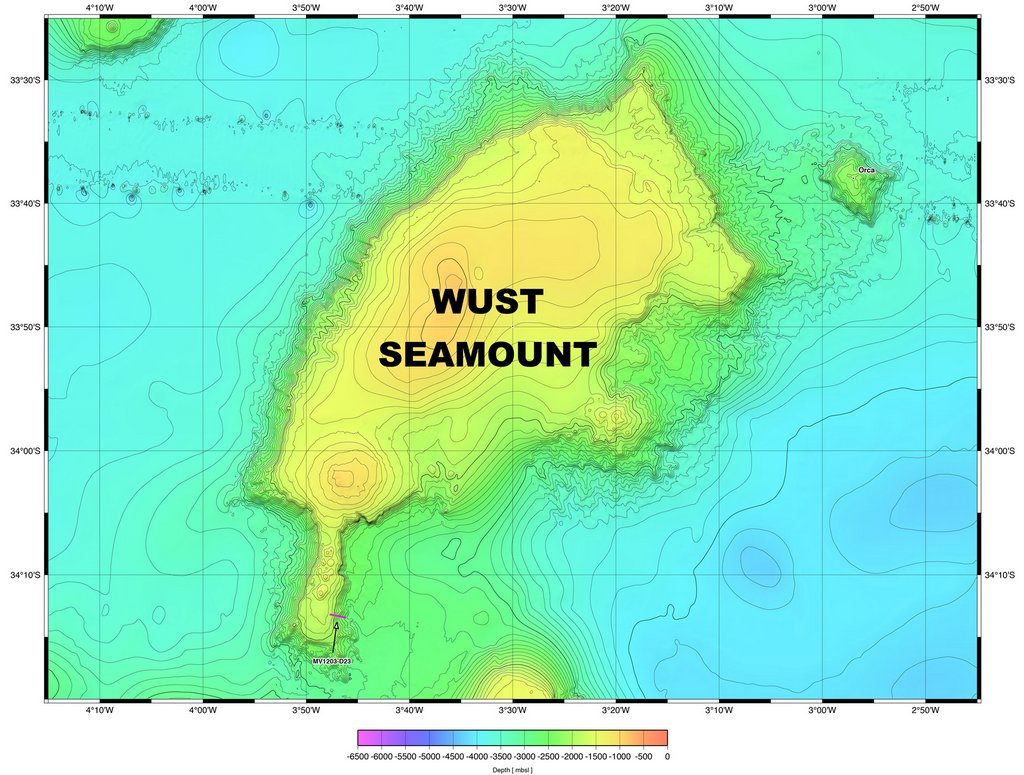  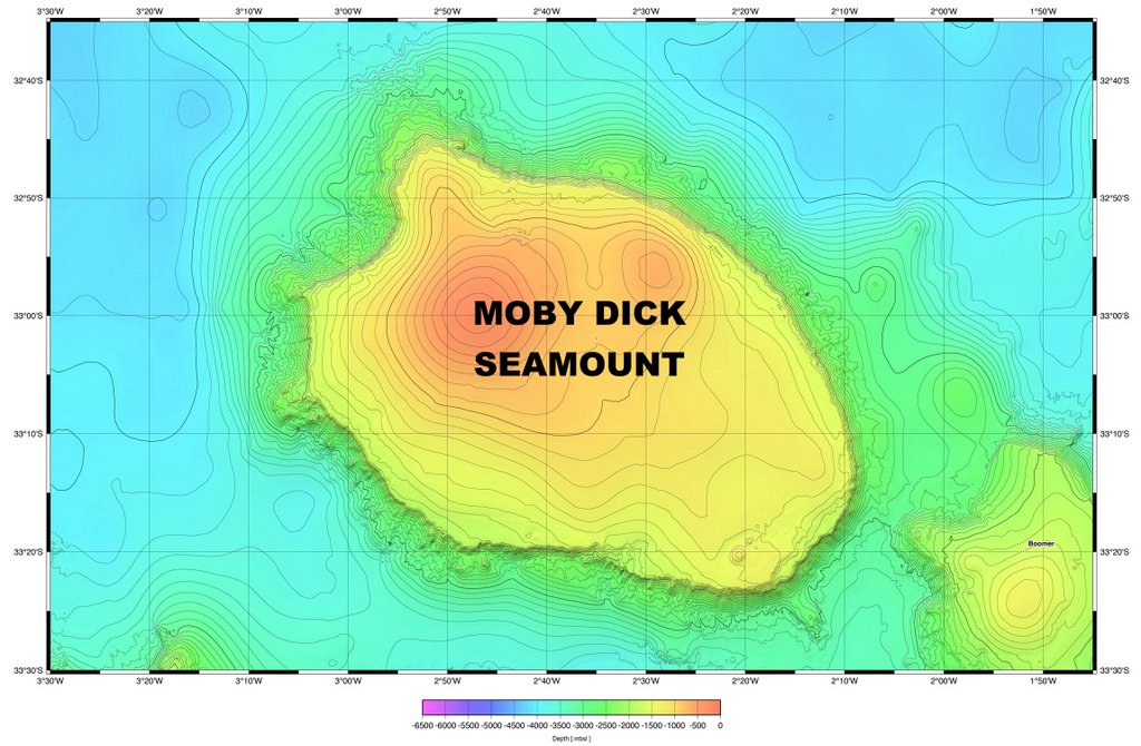 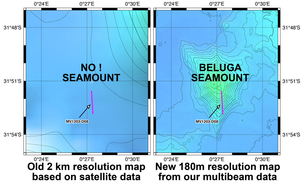 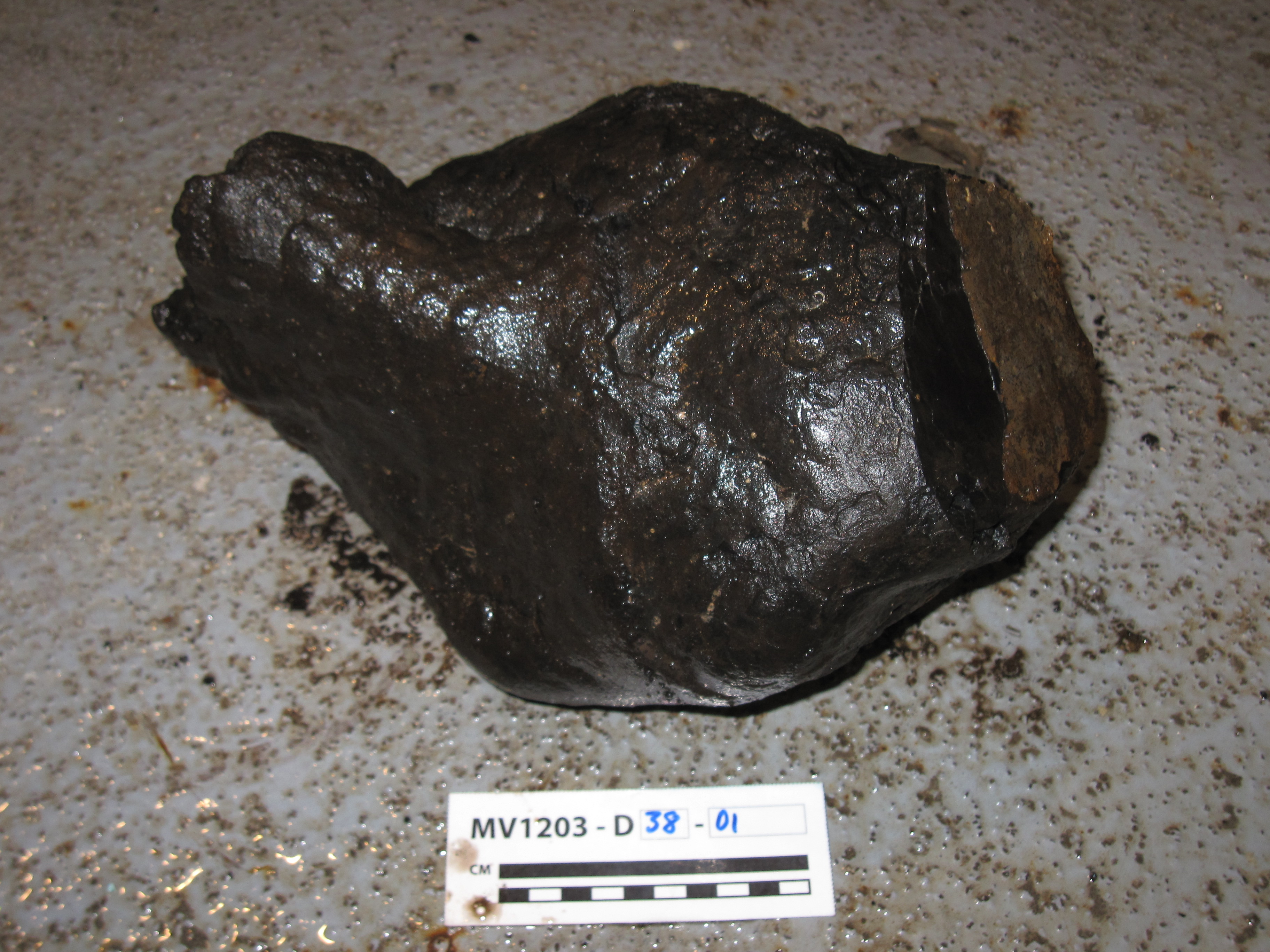 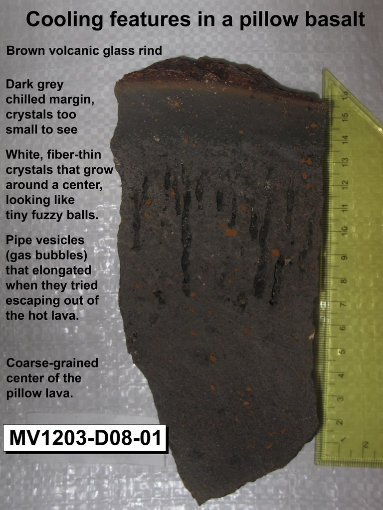 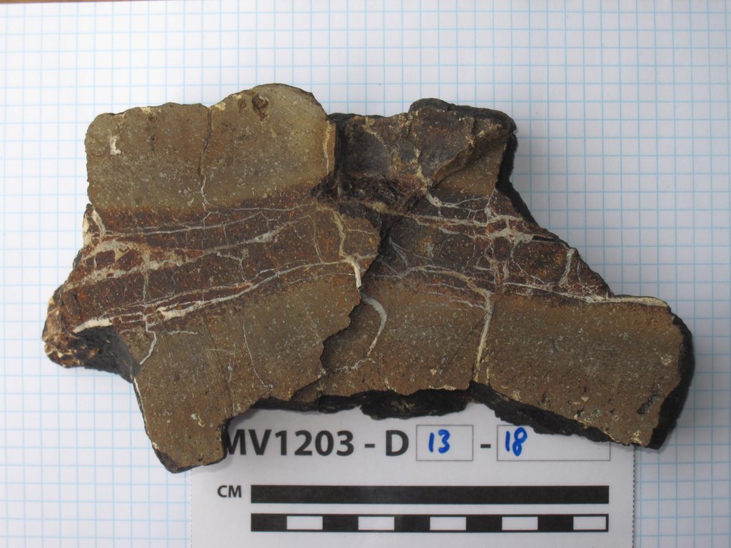 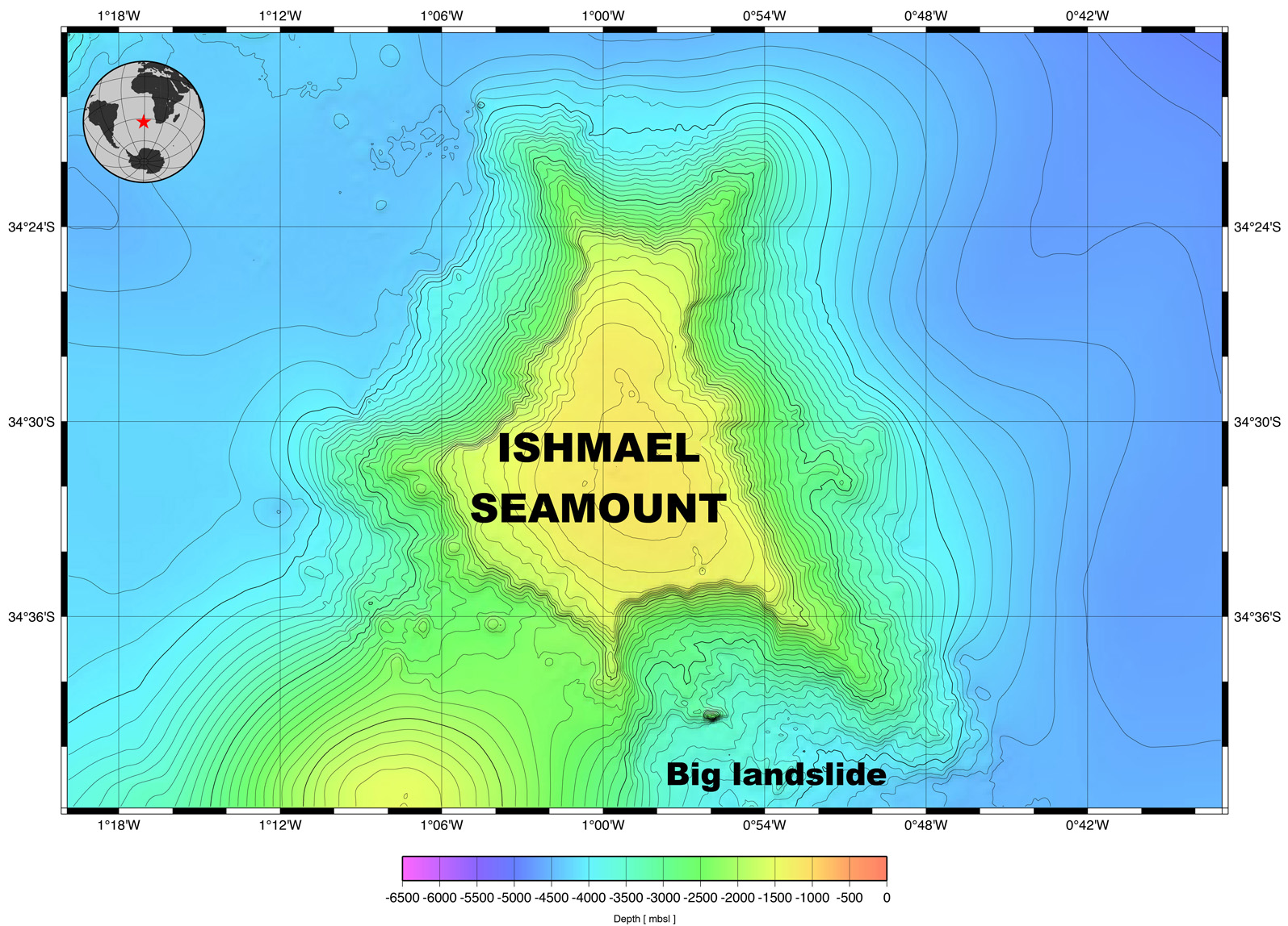  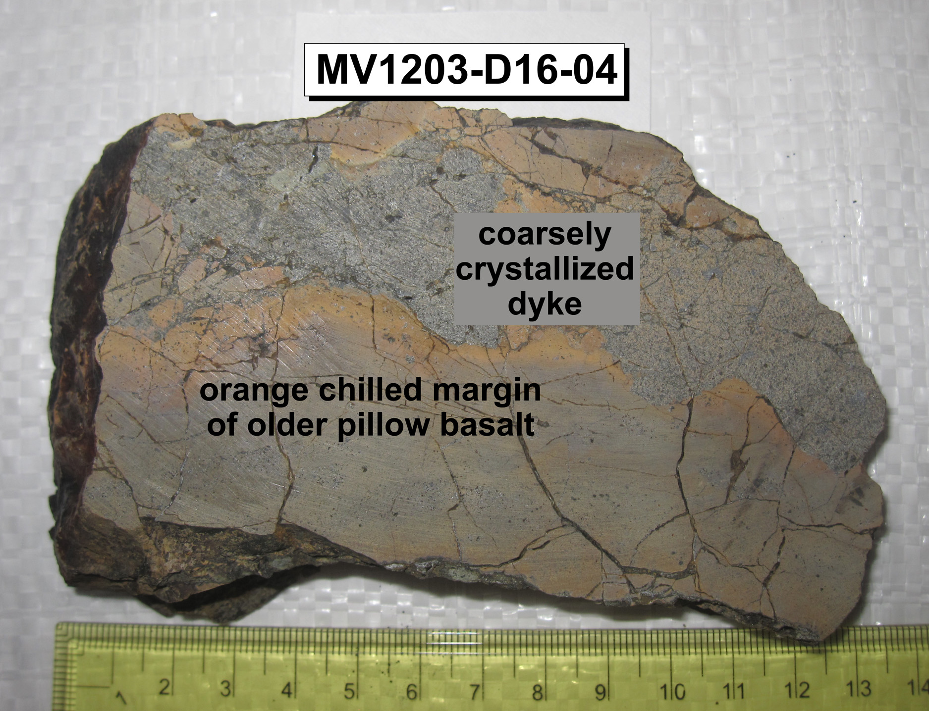  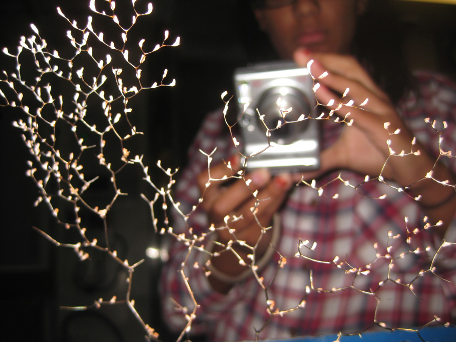 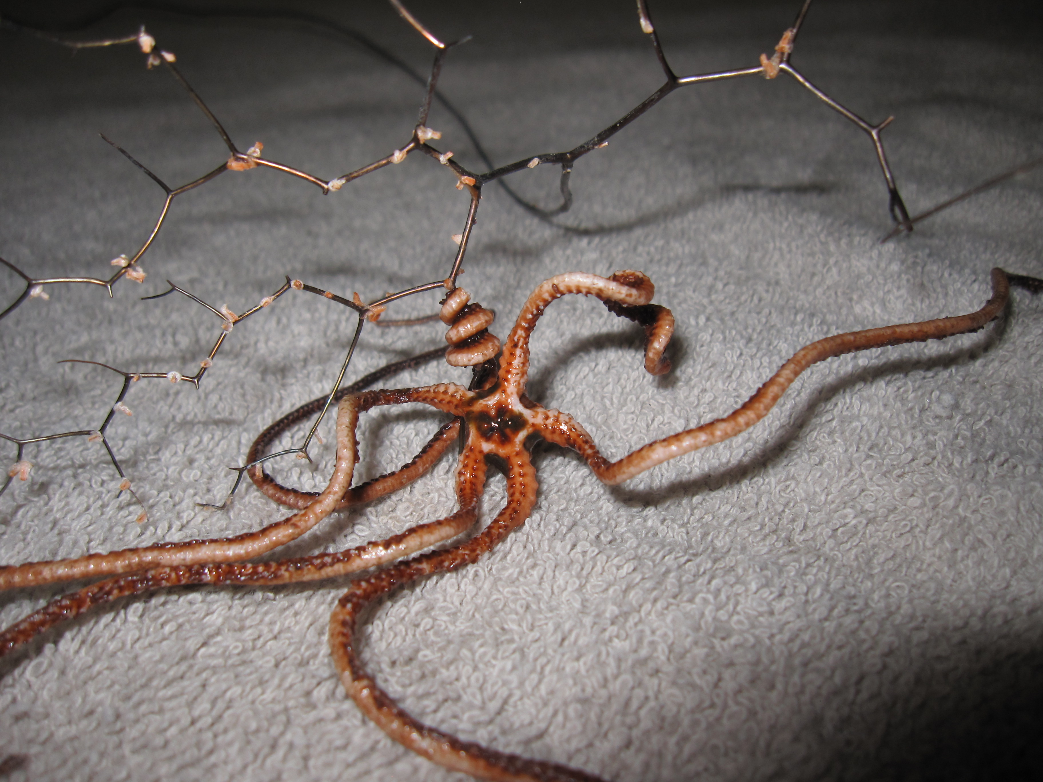 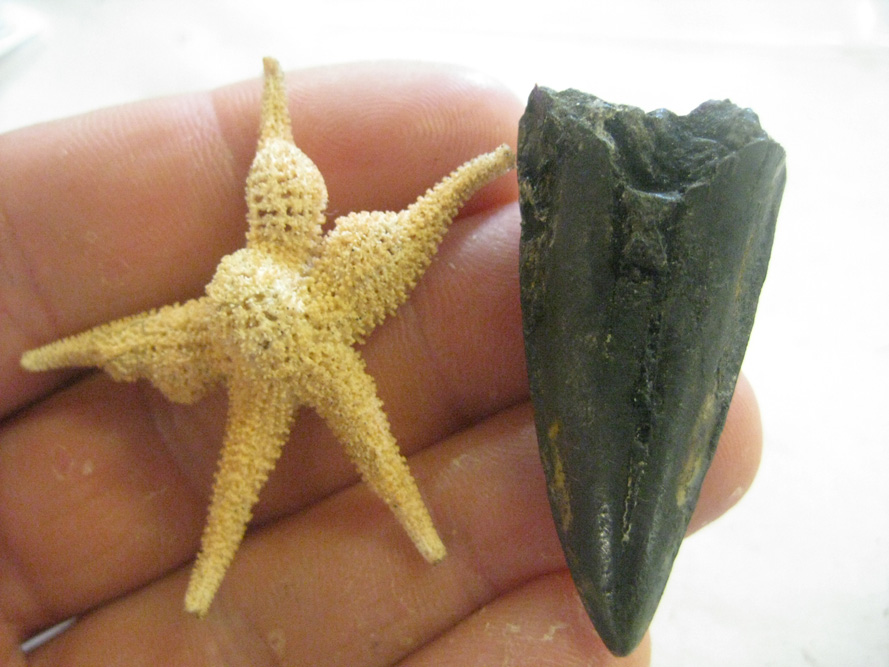 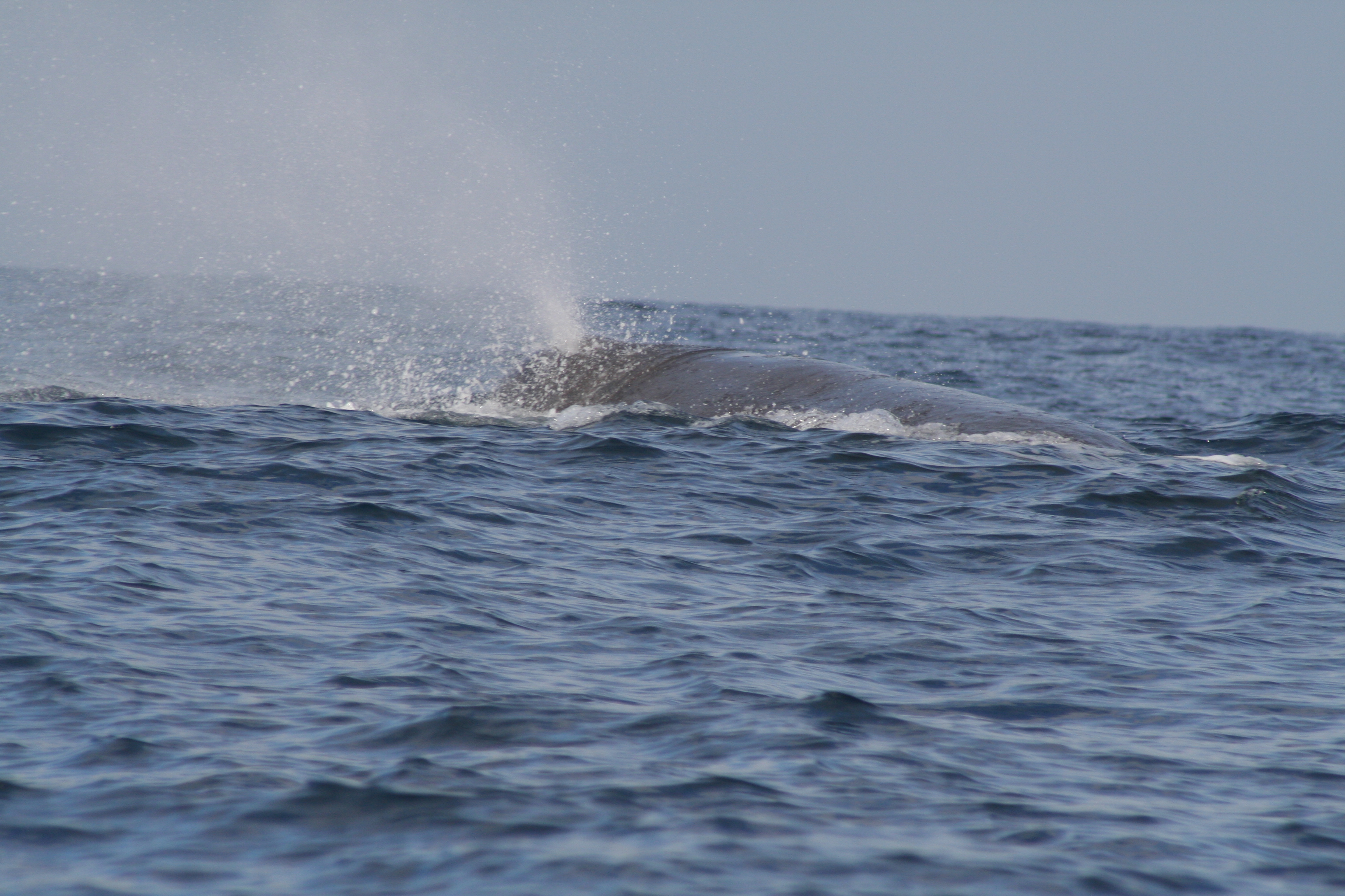 |
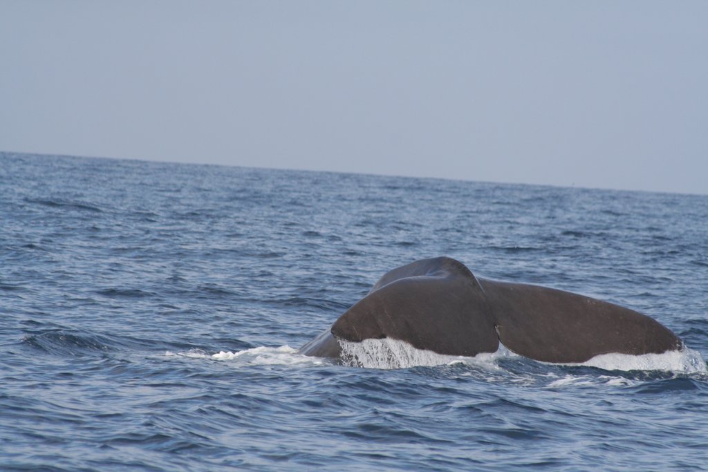
Exploring the hidden world of seamounts In today’s world it is difficult to find a patch of land that has not been explored, named, measured and visited by many already and even the most extreme environments seem to have attracted hordes of explorers. The true remaining frontier in exploration lies deep in the oceans, a hidden underwater world. The area that this cruise MV1203 is investigating had a few short visits by previous cruises, however, out of the 45 seamounts that we investigated, 42 are true “white spots” on the ocean floor map, only previously imaged by satellite data. It would be truly amazing to be able to use a submarine to visit these hidden mountains in the sea, but this is too expensive and time consuming. So we are happy with our more crude approach, firstly producing high resolution maps of the seamount with multibeam data as well as dredging their flanks to sample the volcanic rocks which built them. I have been working with volcanic rocks of the type forming seamounts during my whole career. They are not exactly the most attractive rocks: they are rough and grey or black and you rarely find them in amateur collections or stores except for the occasional “lava jewelry”. So I just did not expect much excitement. Now, looking back at more than 40 successful dredges, I am totally fascinated by the beauty that lies in the diversity of the rocks we found and what they can tell us. Just as fascinating are the pieces we got to see of the hidden gardens of the deep sea. It is this excitement I would like to share in this article. Dredge 23 from the large Wust seamount (Map 1) brought up sediment full of volcanic round pebbles and coarse volcanic sand (Photo 1). The only way such sediment can form is by the wave action on a beach. Curiously these rocks were dredged from 2700-1940 m water depth, which is about 9000-6000 feet deep. There is obviously no beach down there today. What these rocks tell us, is that there was a beach on Wust in the past. Like many other seamounts, Wust is a former ocean island, like today’s Hawaii. Similar to the older islands of the Hawaii chain, Wust got eroded by waves on the surface and basically flattened down to the level of the sea. This gives it the characteristic shape of a flat-topped seamount, a so-called guyot like many seamounts in the area (e.g. see also Map 2, Moby-Dick Seamount). Such former islands keep sinking deeper and deeper for two reasons. Firstly, the older the seafloor the more it sinks down as it gets colder and denser. Therefore the oldest ocean floor forms the deepest basins in the oceans. Secondly, many seamounts are formed by a hotspot, which pushes up the plate and forms a swell. As the plate moves away from the hotspot, the seamount sinks down. The beach pebbles are proof that Seamount Wust was once an island many million years ago and we can date the pebbles and will be able to tell how long ago precisely. Beluga Seamount, a 1.5 km high extinct volcano, was a real discovery as its existence was unknown until our cruise made a high-resolution multibeam map (Map 3). Dredge 08 off Beluga Seamount brought up textbook examples of pillow lavas, which form when magma erupts under water. Naturally, when an ocean island is growing, it forms first by underwater eruptions, slowly building up in size as one pillow lava flow covers the previous ones until it finally reaches the surface of the ocean and forms an island. The pillows are indeed round features and photo 2 shows a good example of a pillow covered with thick black manganese crust and it was cut open on the right showing the volcanic rock inside. The beauty in the pillow lavas that we found lies in the perfect cooling features (photo 3). On the outside is a chilled margin, which is very fine-grained or even glassy as there was no time for crystals to grow when it cooled rapidly in the cold seawater. Towards the interior of the pillow are elongated pipe vesicles and increasing numbers of spherulitic crystal as well as visibly coarse crystallization in the center. The spherulites are elongated crystals that grow rapidly in all directions around a nucleation point, giving it the appearance of tiny white fuzzy balls. Because pillow lavas erupt in water, their surface cools so rapidly that no crystals can grow and instead a skin of volcanic glass forms. Volcanic glass is very similar to the glass that we know from windows or the glasses we drink from, which are produced in factories by cooling molten silica rapidly so that it does not crystallize. Volcanic glass has a somewhat different composition, containing only about half the silica, while the remaining ingredients give it a black color. Volcanic glass is shiny like crystals but crystals break along flat surfaces controlled by their crystal structure. Broken pieces of a window or drinking glass, and in the same way volcanic glass, show conchoidal fractures, which means they resemble the curves of a mussel shell. Indeed we found pieces of black volcanic glass with conchoidal fractures in some of the pillow surfaces. Why is that so exciting? Firstly, glass generally alters rapidly in seawater, so one does not expect it on seamounts that are many millions of years old. Where we found it we have good reason to assume that the rock is probably 40-60 million years old and was around already when no humans, but other creatures roamed the Earth. Special circumstances allowed the glass to survive, because two pillows formed next to each other, enclosing their glassy surface with rock and thus the glass sits now well protected in the middle of a rock (see photo 4 – the glassy pillow rims from two adjacent pillows is the orange-dark brown band through the middle of the rock). And why do we care? Because these glasses might allow us to measure gases in the lava (e.g. CO2, water vapor, helium), which are only preserved in the rapidly cooled glass, but lost from the rest of the lava by degassing through bubble formation (the vesicles in the lavas). Why these gases are interesting will be explained in a different article. Dredge 16 on Seamount Bulkington on the Bulkington Fracture zone brought further excitement as we were looking into the inside of a volcano! As I explained before, a seamount or ocean island forms by stacking one lava on top of another. If it forms an island, erosion by water can cut deep in the rock and we can see deeper levels within the volcano. Most of the Walvis seamounts got their island part flattened out, yet under water erosion does not cut deep into the mountain. Only if a big land slide happens, when a side of a seamount becomes unstable and slides down like an avalanche, then its inside might get exposed. We saw this on our first seamount Ishmael (Map 4 – by the way, such landslides can cause tsunamis, but this is another story). However, at the Bulkington seamount dredge site we had another special case. There are big cracks in the ocean crust called fracture zones and Bulkington volcano sits on the side of one such fracture zone. Past movements that happened along this fracture basically cut about a third away from the volcano (Map 5). This is like cutting a side off a cake so that you can see its inside. At Bulkington we found more coarsely crystallized rocks, indicating that they cooled slowly (photo 5). The explanation for this is that they represent feeder dykes inside of the volcano and did cool slowly as they were protected from the cold seawater. Feeder dykes bring magma to the surface of a volcano and “feed” lava flows. We found a sample that shows a pillow basalt next to a feeder dyke that crystallized more coarsely. The pillow formed first while the volcano was growing. The feeder dyke was emplaced later into this pile of pillows well within the volcano structure. So we got a glimpse of the inside of a volcano. But in fact, the volcanic rocks from these seamounts provide a window to the deep mantle, probably from as deep as the core-mantle boundary, about half way to the center of the Earth. This is where we think the Walvis plume has its origin. From there it rises all the way through the mantle, starts melting and forming magmas at about 150-100 km depth and the magmas then rise and break through the rigid outer shell of the Earth (the plates), where they form the seamount volcanoes. The plates are what we live on and they are in constant motion over the surface of the Earth, which we call plate tectonics. The plates are rigid whereas the underlying hotter mantle moves like a liquid though it is important to note that it is not molten everywhere, only in special places like a hotspot. Magmas contain gases like soda contains dissolved CO2 that is only released when we open a bottle or shake a soda drink. Volatile-rich magmas break with force through the overlying plate and can bring pieces from the plate to the surface, which we call xenoliths (the word means that it is a rock that is not part of the magma itself). Such xenolith-bearing lavas are rare and we did not anticipate that we could find one, but we did in dredge 20 off Humpback Seamount, a small seamount south of the biggest seamount in the area called Moby Dick. We cannot tell much about these samples yet, but they look very different (photo 6). We need to study their composition, which will show us if there was normal oceanic seafloor in the area. We are very excited that we got to peek into the inside of a volcano, got a glimpse at the underlying oceanic plate, and more detailed work on these rocks will provide us with new insights on processes happening deep within the mantle, probably as deep as the core-mantle boundary! Just as exciting as the dredged volcanic rocks are the little pieces of the hidden underwater gardens that we got to see. First there was Jerome, named by the students on board the Melville. Jerome is an angler fish. Angler is another word for fisher man and the fish is called this because attached to its forehead it has a sort of fishing rod and the end of it glows in the dark. The angler fish lives in the ocean at such great depth that the sunlight does not reach it and it is pitch black. The little light on the fishing rod of the angler fish attracts other fish and animals and helps the angler fish to find food. This is already pretty bizarre, but what totally surprised us was to see that the fish has four extra fins on the bottom that look like hands and feet. We did not find out which kind of angler fish Jerome is, but there is a relative of his that lives off Australia, called the hand fish, and these fish “walk” indeed on their “hands” along the bottom of the sea (check out the link to the hand fish photographed in National Geographic which shows how the hand fish walks! It's glowing “fishing rod” sticks up above its mouth). So poor Jerome was going for a walk at the bottom of the sea between 4575 and 3400 m water depth (15,000 to 11,000 feet!) when our dredge came by and scooped him up. We felt really bad, but looked with awe at this exotic creature from deep down in the ocean. We also brought up quite a few corals. We have no specialist of deep water corals on board, so we do not know much about them, but they give us an idea of the beauty of the hidden deep water gardens that flourish down there. Dredge 38 off Hector Seamount brought a very delicate coral to the surface that looked like a blooming miniature cherry tree (Photos 7, 8). The bizarre thing is that each of these little coral trees is home to exactly one individual brittle sea star. There was also a lot of excitement when dredge 41 off Spinner Seamount brought up a big piece of sediment covered with thick manganese crust (remember, the black stuff that precipitates on everything in the ocean). As we were looking for rocks in the sediment we found a big shark tooth inside of the manganese crust! In addition, a small sea star travelled up with the dredge (Photo 9). And maybe the most excitement came with the visit of some whales. After all, Walvis Ridge in English would be Whale Ridge. I was lucky, walked out one day and a huge sperm whale was right in front of the bow. It did not move and so the ship had to make a turn not to hit it. Just when it was up close, it dived down and showed its tail (I had no camera with me, so photos 10-12 are from another location in the North Atlantic). |
|
 |
||
|
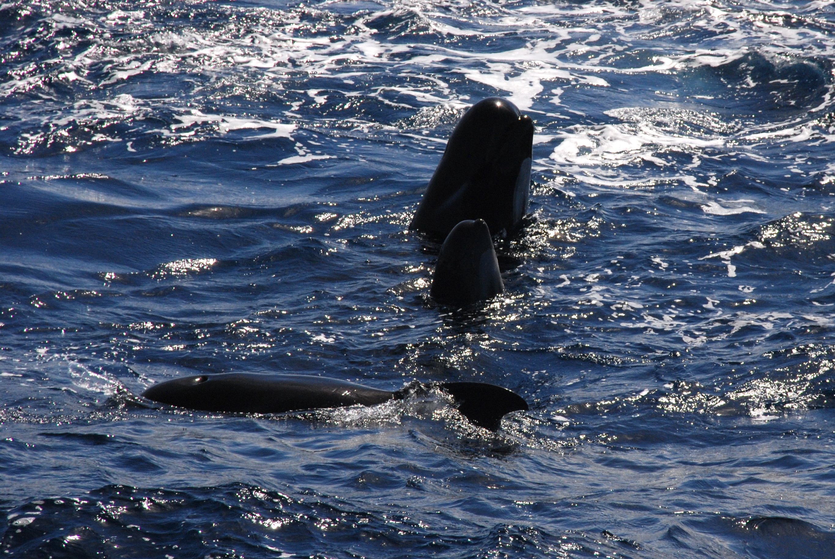
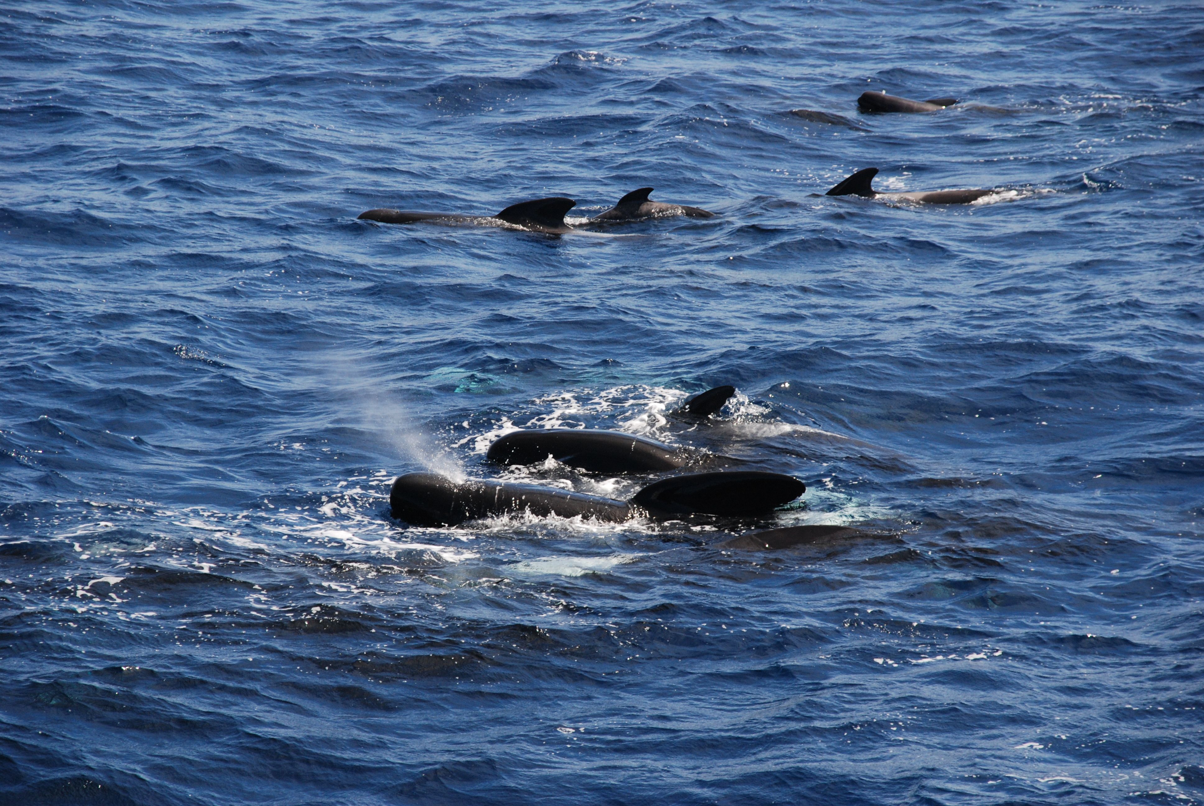
Later during the journey we saw another smaller whale, called pilot whale, who lives in groups (pods). The pilot whales were very curious and came close to the ship to check us out. It was fun watching them play in the waves. And once in a while they would stick out their heads and look at what we were doing (Photos 13-14). |
||
 |
||
|
We are getting close to the end of our cruise, only 8 more days left. But we still have 5 dredges planned as we slowly sail back towards Cape Town, South Africa. I am curious to see what unseen treasures these last dredges will bring up from the hidden world of the Walvis Ridge seamounts. Cornelia Class |
||

- 5752 reads