Daily Science Report 4 -- Wednesday, 15 February 2012
 The R/V Melville set sail at 1600 on Saturday, February 11, 2012. The transit time to our first waypoint was 3 days and 3 hours. During our transit time the science screw had a chance to gain their sea legs and prepare the ship’s science bay for rock analysis and processing.
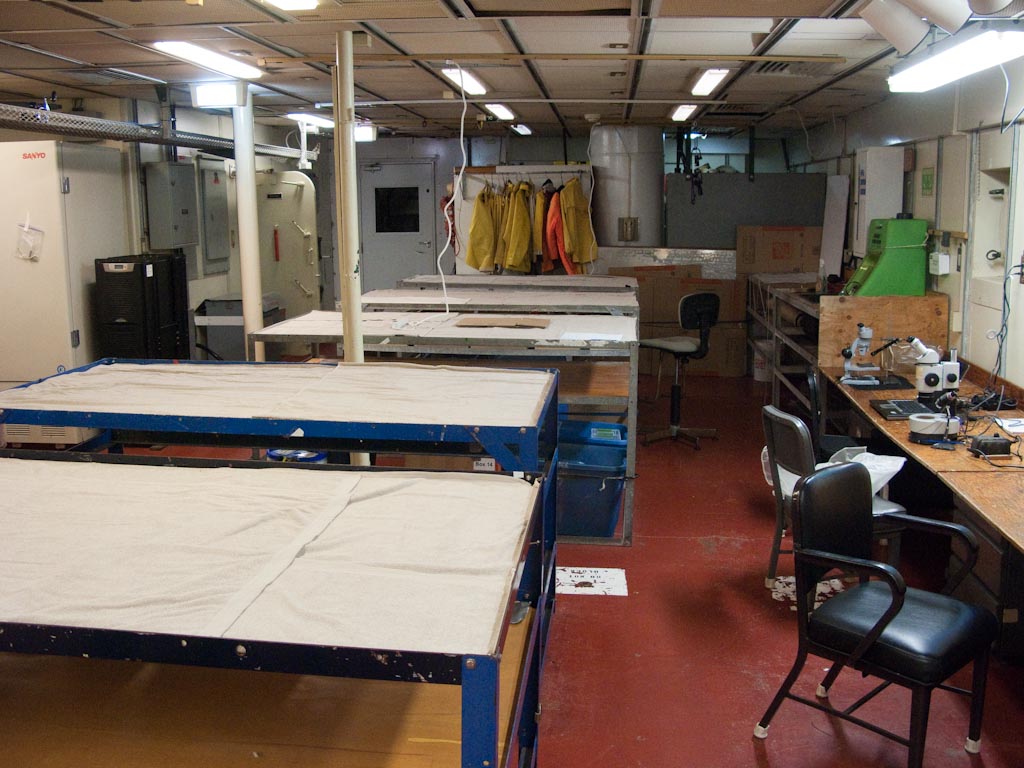 Tables were constructed along the length of the lab and stocked with rock processing supplies. Towels cover the tables in order to dry off samples after they are finished being cut with rock saws and rinsed with fresh water to remove sediment and seawater ooze and rock sawing mud. Megascopic microscopes were mounted to the desks for petrographers to use to assist in identifying the mineralogical characteristics of dredged rocks.
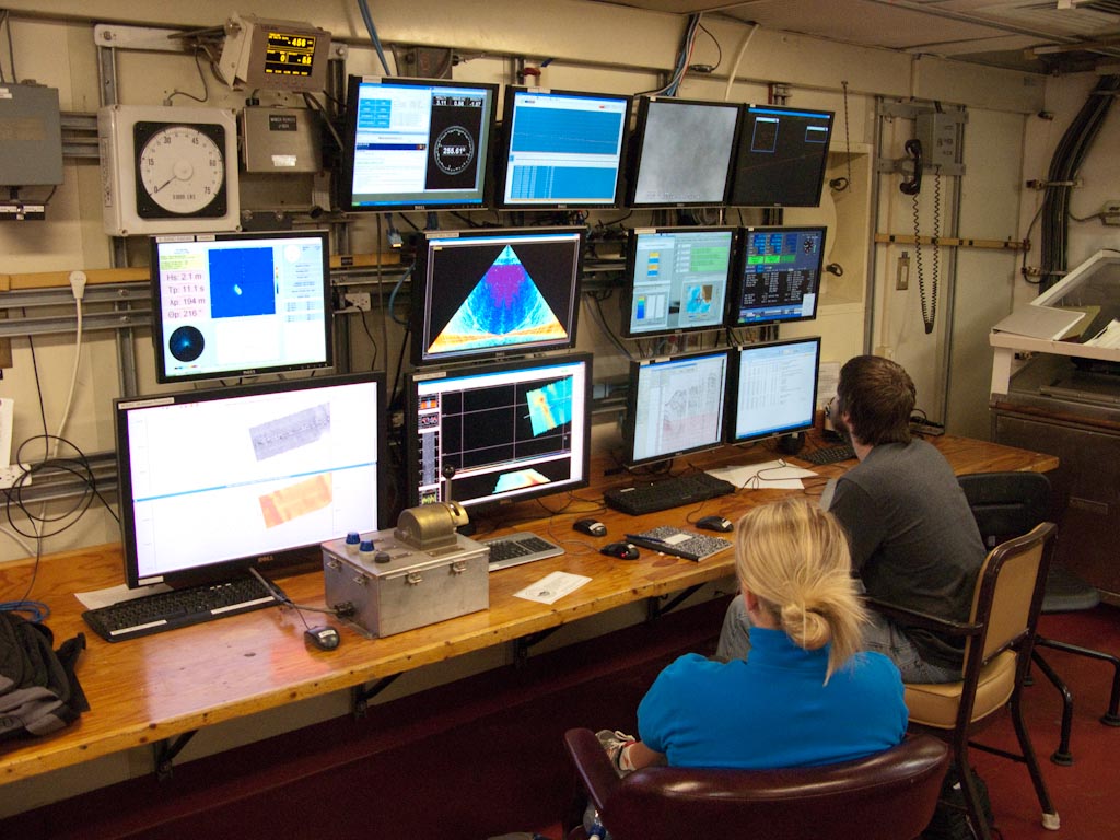 Adjacent to the rock prep area in the science bay, scientists are looking at real-time data that the R/V Melville is collecting. During our time in transit the focus has been to collect magnetometer data (for mapping magnetic reversals see top blue screen, 2nd from left) and map features of seafloor using the Melville’s onboard Simrad EM122 multibeam sonar (three largest screens in the middle and bottom left).
A level up from the science bay a computer lab has been set up to process multibeam sonar data so that maps can be generated of seamounts as we have finished or are busy surveying them. These maps will be instrumental during the dredging process in order to determine the best possible location to dredge.
Stay tuned for more regular updates!
Daniel Heaton
- 3159 reads