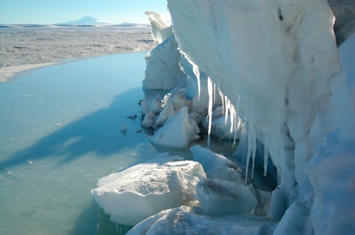
The frigid moat at the edge of the sea-ice
As the ice bunches up along the shoreline, a moat forms on the sea-side that is often filled with water. How deep is the water and how deep is the ice underneath? Not to mention the ocean below.
| Photographer | Hubert Staudigel |
| Region | Antarctica |
| Location | McMurdo Sound, Turks Head |
| Day | 18 |
| Site | |
| Latitude | -77.66665 |
| Longitude | 166.78033 |
| Elevation | 0m |
| People | unknown |
| Keywords | Antarctica, TAFI Project, Erebus Volcanic Province |
|