On our exploration of the Rio Grande Rise, we aimed to dredge rock samples from seamounts and escarpments on the seafloor. In order to dredge the ocean floor effectively, we need to be able to map what’s down there in detail. The existing maps of the ocean floor are based on satellite bathymetry. On a large scale—for example, a whole ocean basin—these maps give a very good idea of the general topography of the ocean floor. Unfortunately, they are rather imprecise and insufficient for dredging. On old oceanic plateaus like the Rio Grande Rise, which might be up to around 80 million years old, hundreds of meters of sediment might have accumulated. Ideally, we would like to know if volcanic rocks are exposed on an escarpment or seamount slope. In addition, slopes that are too steep or too rugged may cause the dredge to get stuck. Very detailed maps of the ocean floor are a prerequisite for successful dredge sampling.
One of the tools we have to achieve a detailed map is the ship’s onboard multibeam echosounder system. Multibeam maps the seafloor by emitting a fan of sound waves beneath the ship’s hull. The array has an emitter and a receiver. The system calculates the two-way travel time of the soundwaves and produces a swath of depth readings from them as they return. The sonar pings once every ten seconds. With the forward motion of the boat, this produces a map of the seafloor.
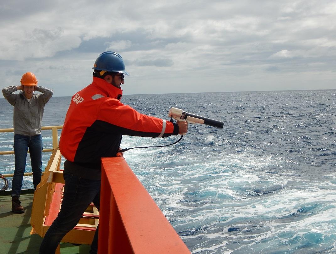 An important component of multibeam operation is the Expendable Bathythermograph, or XBT. This small torpedo-shaped probe is dropped over the side of the ship and sinks to a depth of about 800 meters, collecting temperature data about the water column along the way. Small wires transmit that temperature data back to the ship where it is recorded and used for further analysis. Changing temperatures affect the density throughout the water column, which in turn affects the speed of sound waves as they travel. Multibeam requires us to know how fast the sound is traveling in order to make an accurate map.
The other half of sea-floor mapping is a CHIRP sub-bottom profiling system. The soundwaves it produces are of a much lower frequency than the multibeam’s. A lower frequency soundwave can actually penetrate the seafloor and bounce off features in the subsurface. For our purposes, if the CHIRP doesn’t penetrate, we know the surface doesn’t contain any sediment and could be a potential dredge site for hard volcanic material. Together these two components help us accurately determine the water depth and pin-point suitable locations to dredge rift-zones and seamounts. Mapping usually takes about 3 – 5 hours, depending on various factors like wind speed and wave height.
- 1263 reads