 One of the scientific goals of the NBP1808 cruise to the Rio Grande Rise is to collect measurements that will improve the plate tectonic reconstruction of the opening of the South Atlantic. How is this done? We are able to measure magnetic anomalies originating in the oceanic crust, which lies 1000-4500 m below the ship.
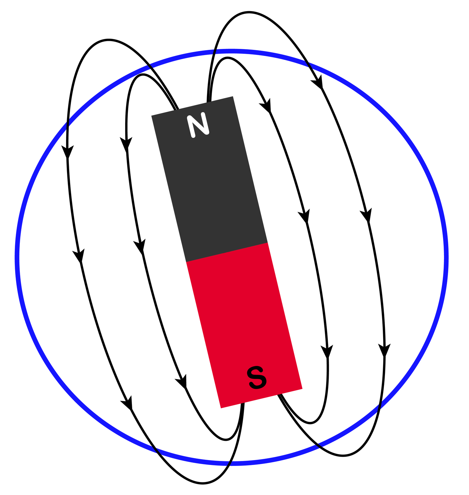
Looking for magnetic anomalies starts with magnets. The Earth behaves very similarly to a dipole magnet with a north-pole, a south-pole, and magnetic field lines between the poles (Fig.1). Most of the Earth’s magnetic field comes from currents in the liquid iron outer core. At irregular intervals those currents shift and the magnetic poles follow suit, with the south pole where the north pole used to be (and vice versa). These reversals of the magnetic field happen rapidly. The field then stays in one state or the other for a time typically ranging from hundreds of thousands to millions of years. The cause for these reversals is still not well understood, but we can use them to understand more about the earth.
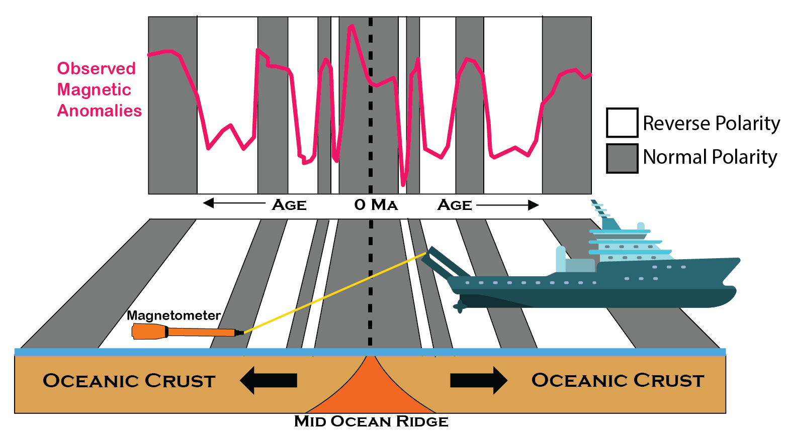 When hot molten magma rises up at mid-ocean ridges to form new ocean crust rock, magnetic mineral grains that contain iron will orient themselves in-line with the current magnetic field. When the rock cools down, the minerals retain their original magnetic orientation even if the earth’s magnetic field reverses. When the field reverses, the new rock records the changed polarity. Many years later we can come along and measure the effect of this “remnant magnetism.” A magnetometer, which measures the magnetic field, sees slight changes in the overall Earth’s field caused by the blocks of different magnetic orientation beneath it. Rocks of one polarity add to the field while the opposite subtracts. With magnetometer measurements we can get a snapshot of the polarity of the earth at the time those rocks were formed. If we do enough measurements over a large area, we see “bands” of crust with either “normal” or “reversed” polarity (Fig2). These reversals can then be traced back to connect which areas of oceanic crust were created at the same time and which are older/younger. Moreover, scientists have pieced together a time-scale of magnetic polarity reversals back in time, so that the pattern of magnetic reversals can be recognized from the measured magnetic anomalies.
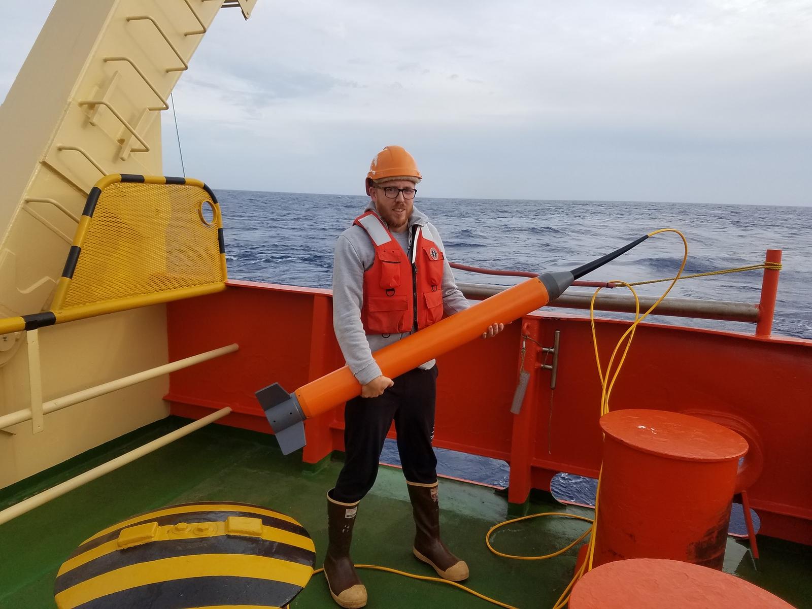 To measure the strength of the magnetic field while on this cruise, we tow a SeaSpy 2 marine magnetometer (the “Maggie”) 300m behind the ship (Fig.3)—far enough away so that the ship itself (a big metal magnet) does not interfere with the magnetic measurements. Our particular magnetometer is also not designed to withstand depths greater than 100m. Every time we slow down and stop to dredge we have to pull in the Maggie or else it will sink too low and be crushed by the increasing pressure.
 The following figures are from work done by Principle Investigator Will Sager and PhD student Sriharsha Thoram, two members of the science party working on reconstructions of the opening South Atlantic—including the area of the Rio Grande Rise. The following figures are from some of their work. Figure 4 shows the magnetic reversals that have been measured prior to the NBP1808 cruise. You can see that for areas older than 68 million years which lie closer to South America there is not a lot of data. There also is uncertainty as to where the 84-million-year marker is located. Our study area of the Rio Grande Rise is ideally located to fill some of these gaps.
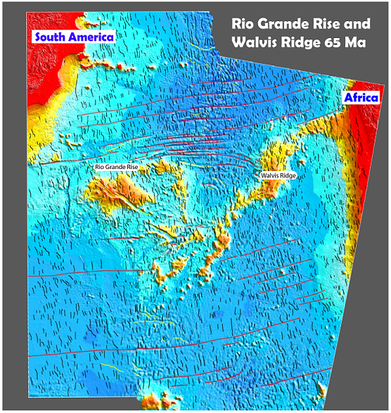 Figure 5 shows a reconstruction of the South American and African plates back to 65 million years ago. The Rio Grande Rise is on the left while the Walvis Ridge feature is on the right; both are also very near the Mid-Atlantic Ridge.
Collecting more magnetic data in this region will help in reconstructing the plates back to their original positions beyond 65 Ma and help give clues to how features like the Rio Grande Rise and Walvis Ridge formed.
By Matthew Sexton
- 3134 reads